

ARC Data & Mapping Tools Provide Insights into Atlanta Region
Open Data and Mapping Hub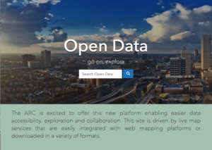
ARC’s Open Data and Mapping Hub offers data accessibility and exploration while showcasing web maps, apps, dashboards and tools across ArcGIS Online and other platforms. Our Hub is driven by live map services from ARC and local governments in the region that are easily integrated with web platforms or downloaded in a variety of formats. Search by keyword or browse by category.
Content found at the ARC Open Data & Mapping Hub include:
- 100 Metros Dashboard
- ABMVIZ - Activity-Based Model Vizualization
- ARC 21-County Data Dashboard
- Population and Employment Forecast Dashboard
- ARC Planning Areas
- Arts Organizations
- Community Agriculture
- Connecting with Parks: A Regional Perspective
- City, County, GA House/Senate, Super District Profiles
- DataNexus
- Freight Dashboard
- GEEARS: Georgia Early Education Alliance for Ready Students
- Livable Center Initiative Storymap (2017)
- Livable Center Initiative Storymap (2025) Arriving Soon!
- Metro Atlanta Building Permit Tracker
- Metro Atlanta Speaks Data Dashboard
- Prevent Child Abuse of Georgia
- Reach Out and Read
- Regional Transportation Plan
- Trails Planning
- Transit Planning
- STEAM Asset Map
- Unified Growth Policy Map
Interactive Data Dashboards
- 100 Metros Dashboard
- Air Quality Dashboard
- ARC 21-County Data Dashboard
- ARC Population and Employment Forecast — Interactive Dashboard
- Congestion Management Process
- Freight Dashboard
- Metro Atlanta Building Permit Tracker
- Metro Atlanta Speaks Data Dashboard
Transportation Data Tools
ARC provides a range of useful tools that offer detailed information about planned transportation projects across the Atlanta region: