
33°n - Finding Meaning of 33.7°N

Monday Mapday: Public Assistance through Food Stamps

Posted Under: 33°n Economy

Written by ARC Research

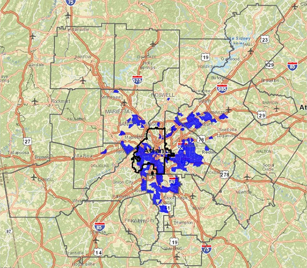
map - public assistance through food stamps

Posted on: September 28, 2015

The areas shown in blue had the greatest increase in individuals receiving food stamps per square mile from 2010-2014 in metro Atlanta. While poverty is still concentrated in the urban core, suburban areas unaccustomed to poverty have seen some of the highest spikes in food stamp usage, particularly in the Marietta and Norcross areas.

Powered by ARC
33°n
CDAP
Community Planning Academy
ConnectA
Empowerline
Georgia Commute Options
Green Communities
LCI
LINK
MARC
Metro Atlanta Speaks
MNG Water Planning District
RLI
State of the Region
UASI
WorkSource GA
33°n
CDAP
Community Planning Academy
ConnectA
Empowerline
Georgia Commute Options
Green Communities
LCI
LINK
MARC
Metro Atlanta Speaks
MNG Water Planning District
RLI
State of the Region
UASI
WorkSource GA


