


Posted on: November 20, 2017
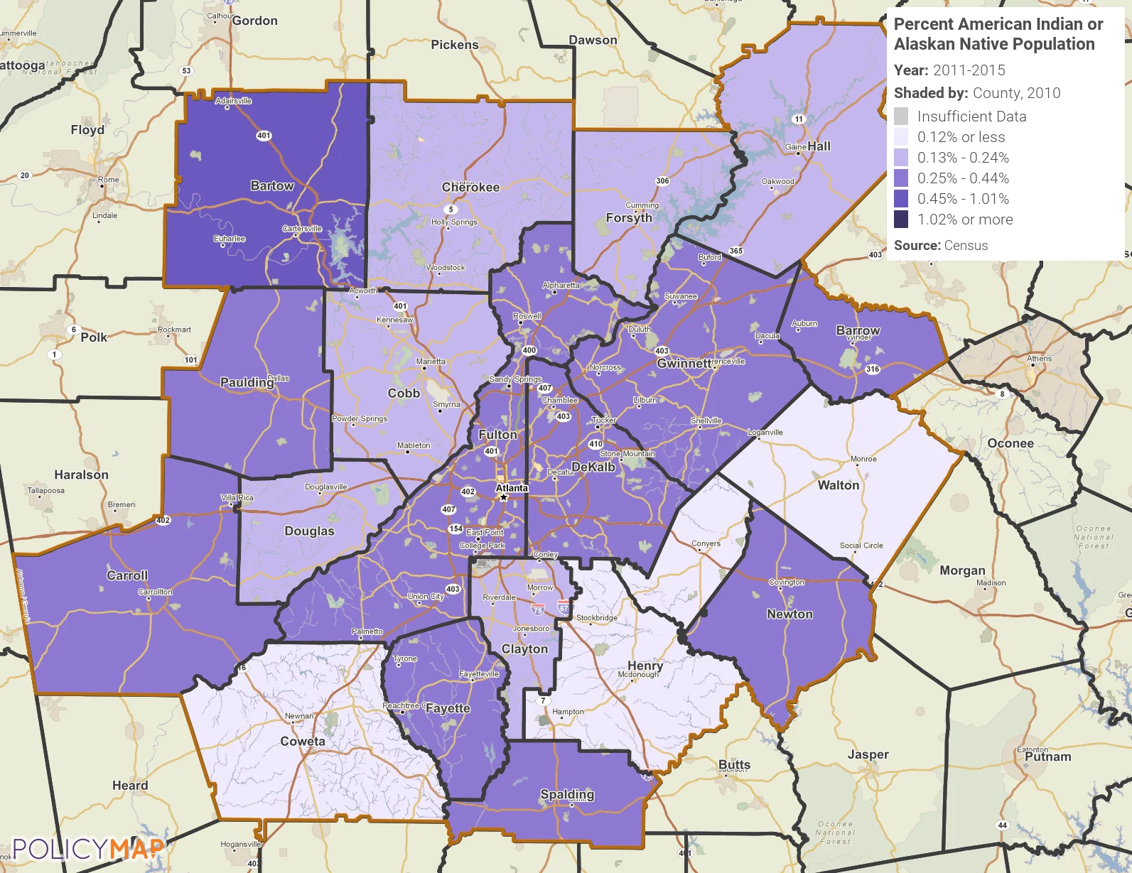
In 1990, President George H.W. Bush signed a joint congressional resolution to designate November 1990 as “National American Indian Heritage Month.” Since 1994, similar presidential proclamations have been issued every year. Today, the month is recognized as “American Indian and Alaska Native Heritage Month.” The map below provides an estimate of the American Indian and Alaska Native population in the Atlanta Metro region. Whereas the number of people with Native American heritage (not in combination with another race)* in most places is quite small, the map below was created at the county level to reduce the margin of error in estimates. As you can see, Bartow County has the largest percentage of Native American people, at between 0.45 and 1.01% of the total population. Henry, Rockdale, and Walton counties have the smallest estimated proportion of Native American people.
In addition to the map below, you are encouraged to look at US Census Bureau’s My Tribal Area tool, which provides data for Tribal Areas in the US.

The map was created using PolicyMap
Data Source: US Census, American Community Survey, 2011-15, 5-year Estimate
* The American Community Survey, 2011-15, 5-year estimate does not provide a population estimate for American Indian and Alaska Native (in combination with another race).







