


Posted on: June 19, 2017
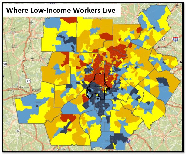
The maps below show a spatial mismatch between the location of low-income workers and low-income jobs. The first map shows the location of the region’s low-income workers by place of residence, with blue shades representing areas with the highest concentration of low-income workers. As depicted in the map, the region’s low-income workers are primarily concentrated south of I-20, and in Clayton and Spalding counties. The second map below shows the location of low-income jobs, again with blue shades representing the areas of highest concentration. Unlike low-income workers, low-income jobs are more evenly dispersed throughout the region. This mismatch between the location of low-income workers and low-income jobs further emphasizes regional housing affordability challenges and underscores the importance of providing a robust regional public transportation system.
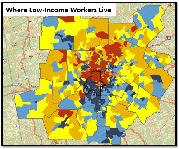
Source: Longitudinal Employer-Household Dynamics (LEHD), U.S. Census Bureau via Neighborhood Nexus
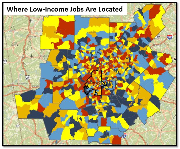
Source: Longitudinal Employer-Household Dynamics (LEHD), U.S. Census Bureau via Neighborhood Nexus







